
Application of GIS and spatiotemporal analyses in viral infection modelling using multiple datasets – A case study on the SARS-CoV-2 epidemic
Viral and infectious diseases, such as COVID-19, pose a significant public health threat. To develop an early warning system for new pandemics or emerging virus variants, studying its epidemiology is essential. This study creates a geospatial model to predict the weekly contagion and lethality rates of COVID-19 in Ireland. Over forty parameters, including atmospheric pollutants, meteorological variables, sociodemographic factors, and lockdown phases, serve as input variables for the model. We identify significant predictors for new cases and death tolls, using QGIS for data processing and a principal component regression (PCR) model developed with the XLSTAT statistical add-on. The models predict over half of the variations in contagion and lethality rates, demonstrating their potential to inform future high-risk condition prediction systems. Future models could incorporate additional parameters, such as death rates in care homes, contagion and mortality percentages among health workers, and compliance levels with social distancing.


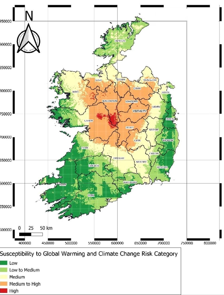
Development of a Web-Based Geodatabase Platform for Natural Hazard Assessment and Multi-Hazard Susceptibility Mapping
This two-phased project for Enterprise Ireland, completed in 2024, involved creating an advanced web-based platform to assess, model, and map natural hazards across Ireland. The platform integrates over 200 geospatial variables (with more than 60 million data points), covering geology, digital terrain models, weather, and land cover, among others. Using robust geostatistical models, we generated high-resolution risk maps for hazards such as landslides, flooding, soil erosion, radon, thoron, gamma radiation, and climate change susceptibility.
Phase one focused on developing a 500-meter resolution grid, where each cell provides a detailed view of individual hazard risks. Phase two combined these indexes to create a multi-hazard risk map, categorized into five levels from low to high, allowing professionals and the public to monitor and assess evolving risk levels.
Designed to support engineers, planners, and local authorities, this platform enables informed decision-making in spatial planning and natural hazard management. It also serves as a flexible resource for future hazard mapping and geotechnical studies, providing a lasting impact on risk resilience efforts across Ireland.

CONTACT US
Whether you’re looking for expert guidance on your project or simply want to learn more about our services, we’re here to help. Reach out to discuss how our team can support your needs in environmental assessment, geotechnical solutions, or advanced geospatial analysis. Contact us today and let’s take the next step together.